
Parkside Master Plan
Atlanta, Georgia


About the property
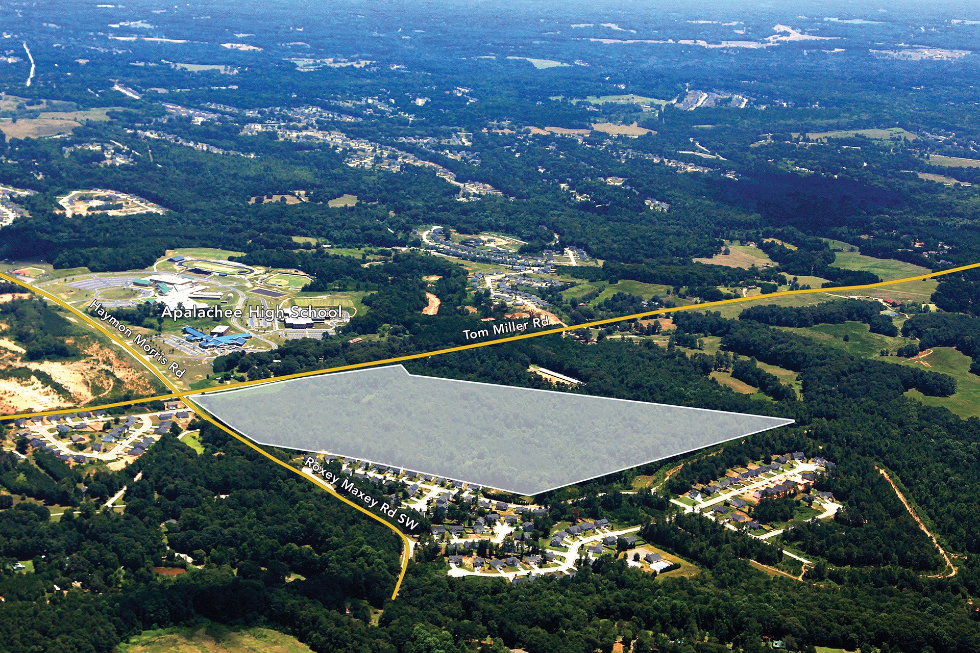
Master Plan Location
The Parkside Master Plan is 56.3 km northeast of Atlanta along the Georgia State Route 316 corridor, near the City of Statham in Barrow County.
Road Access
The Master Plan is located along US Highway 316 (US-316), which connects Lawrenceville with Athens and provides access to Atlanta and Interstate 85. US-316 has good traffic counts and provides good exposure and visibility for the property. The Master Plan has approximately 1,000 feet of frontage along Tom Miller Road to the east, and approximately 600 feet along Roxey Maxey Road to the north.
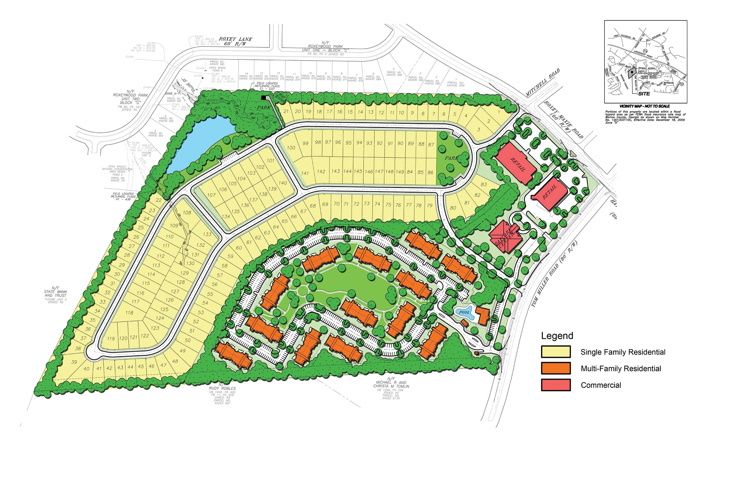
Land Use
Barrow County rezoned the tract and approved the creation of a High Density Residential zoning, with special use approval as a Master Planned Development zoning district to support the mixed-use development. The approved zoning allows for single-family, multi-family and neighborhood commercial development.


