
Kimberlin Heights Master Plan
Dallas - Fort Worth, Texas


About the property
Master Plan Location
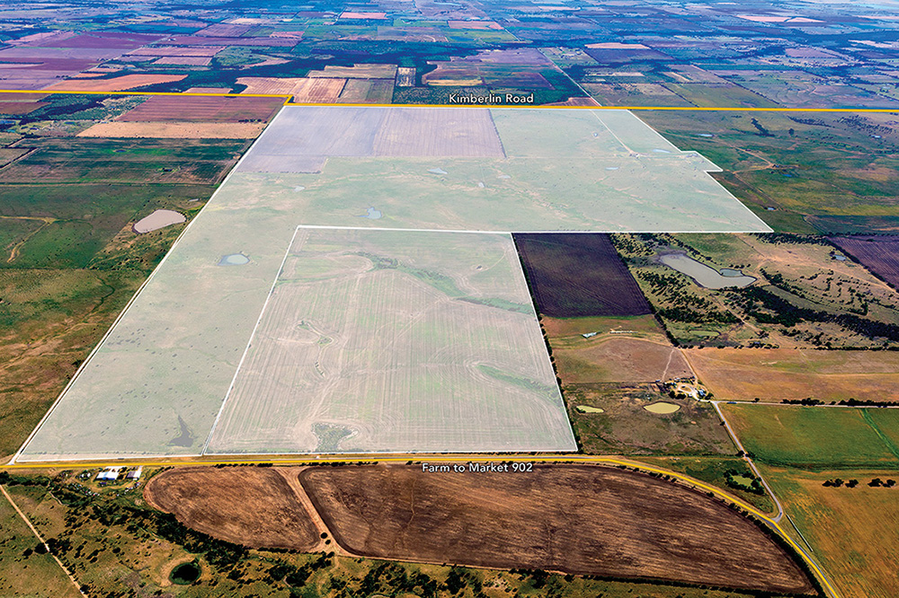
The Kimberlin Heights Master Plan is located east of the Dallas-Fort Worth area in Grayson County.
Road Access
The Master Plan is located approximately 5 miles west of State Highway 289 (Preston Road), adjacent and south of Farm to Market Road 902, and is projected to be bisected by the future Dallas North Tollway extension, a main north-south highway connector extending into Dallas, Texas.
Land Use
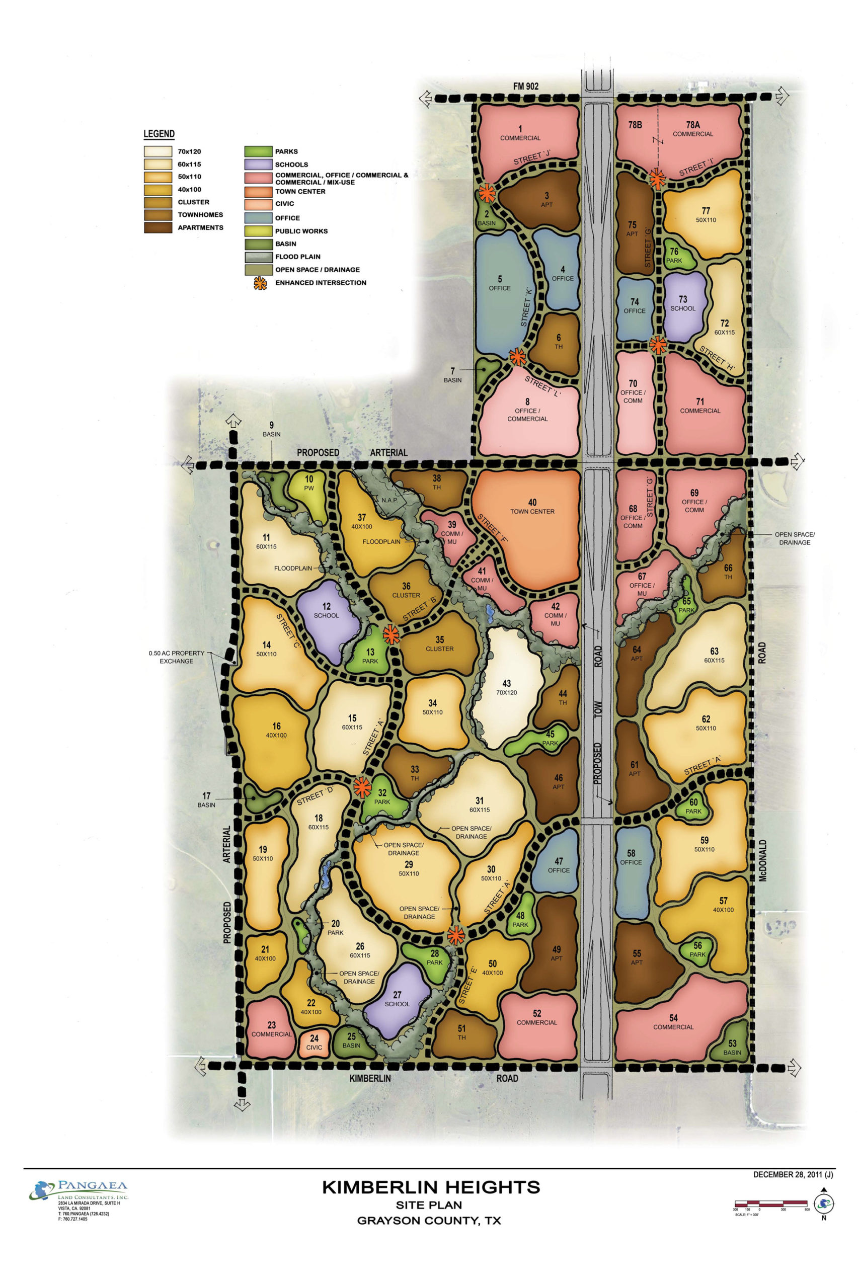
The entire Master Plan is entitled and located within the Grayson County Double Platinum Ranch Water Control and Improvement District, No 1. The Master Plan is being planned as a mixed-use master plan including a variety of single-family, multi-family, schools, retail and office land uses with higher intensity land uses adjacent to the future Toll Road that will bisect the property. Amenities will include trails, amenity centers with pools, and active and passive open space parks.


Please wait while you are redirected to the right page...

